Home || Site Map || Add to Favorites
About Us :: About Iceland :: Iceland Cities :: Travel Guide :: Travel Resources
| HOTELS IN ICELAND | |||
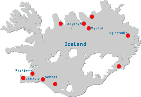
| Hotels in Akureyri | |||
| Hotels in Borgarnes | |||
| Hotels in Egisstadir | |||
| Hotels in Fludir | |||
| Hotels in Keflavik | |||
| Hotels in Kirkjubaejarkaustur | |||
| Hotels in Myvatn | |||
| Hotels in Reykjavik | |||
| Hotels in Selfoss | |||
 |
|||||||||||||||||||||||||||||||||
|
|||||||||||||||||||||||||||||||||
Hotels in Iceland :: Cheap Hotels in Iceland :: Luxury Iceland Hotels :: Budget Hotel Iceland :: Iceland Tourist Attractions
Star Hotels in Iceland :: Discount Hotels in Iceland Copyright © StayResIceland.com. All Rights Reserved.